Search this site:
Home
::
Physical Resources
::
Geologic Features
::
Geologic Resources Inventories
::
Project Reports
Project Reports for Geologic Resources Inventories
Project Reports
Project Report
Chiricahua National Monument Geologic Resources Report
Mesa Verde NP Geologic Resource Report
Navajo NM Geologic Map
Navajo NM Geologic Resource Report
Petrified Forest NP Geologic Map: Northern Extent
Petrified Forest NP Geologic Map: Southern Extent
Petrified Forest NP Geologic Resource Report
Rainbow Bridge NM Geologic Map
Rainbow Bridge NM Geologic Resource Report
Saguaro National Park Geologic Resources Report
Sunset Crater Volcano NM Geologic Resource Report
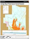
Walnut Canyon NM Geologic Map
Walnut Canyon NM Geologic Resource Evaluation Report
Yucca House NM Geologic Map
Topics
Biological Resources
Aquatic Invertebrates
Aquatic Nuisance Species
Biological Soil Crusts
Birds
Fish
Mammals
Bats
Prairie Dogs
Reptiles and Amphibians
Vegetation
Deserts
Forest & Woodlands
Montane Forests
Grasslands
Invasive Exotic Plants
Plant Inventories
Riparian & Wetlands
Vegetation Mapping
Physical Resources
Air Quality
Climate
Climate Change
Geologic Features
Soils
Water
Ecosystems & Landscapes
Climate Change
Disturbance Dynamics
Fire Ecology
Fire Management
Paleoecology
Humans & the Environment
Environmental Histories
Land Use
Natural Soundscapes
Visitor Use
Archeology
Dendrochronology
Prehistoric Cultures
Ancestral Puebloan
Ancestral Puebloan Ruins
Hohokam
Mogollon
Salado
Overviews
Salado - Ceramics
Sinagua
Trincheras
Defining the Southwest
Cultural Definitions of the Southwest
Environmental Definitions of the SW
Colorado Plateau
Transitional Highlands and the Mogollon Rim
Southern Basin and Range
Southwestern Plains
River Environments
Glossary
Understanding Archeology
What do Archeologists Do?
Types of Archeology
History of Southwest Archeology
Archeological Sites
Artifacts and Features
Context
Methods
Glossary
Important Laws
History
Buffalo Soldiers
Environmental Histories
Historic Structures
Fort Davis Post Hospital
Faraway Ranch
Manning Cabin
Santa Fe Trail
Spanish Missions
Tumacácori
Ethnography
Environmental Histories
Museums and Collections
Western Archeological and Conservation Center
Southwestern National Monuments (SWNM)
Ruins of The Southwest
Science-based Management
Communication Tools
Conceptual Diagrams
Conceptual Models
Management into Science
Adaptive Management
Developing Effective Objectives
Objectives Hierarchies
Science into Management
Adaptive Management
Assessment Points
Bayesian Inference
Decision Support Systems
Diffusion of Innovations
Ecological Thresholds
Evidence-Based Conservation
Thresholds of Potential Concern
Science and Management Workshops
Rio Rico 2005
Chico Hot Springs 2006
George Wright Society 2007
I&M Climate Change 2010
Parks & Protected Areas
Arizona
Canyon de Chelly NM
Casa Grande Ruins NM
Chiricahua NM
Coronado NMEM
Fort Bowie NHS
Grand Canyon NP
Hubbell Trading Post NHS
Montezuma Castle NM
Navajo NM
Organ Pipe Cactus NM
Petrified Forest NP
Saguaro NP
Sunset Crater Volcano NM
Tonto NM
Tumacacori NHP
Tuzigoot NM
Walnut Canyon NM
Wupatki NM
Colorado
Bent's Old Fort NHS
Mesa Verde NP
Sand Creek Massacre NHS
Yucca House NM
Kansas
Fort Larned NHS
New Mexico
Aztec Ruins NM
Bandelier NM
Capulin Volcano NM
Carlsbad Caverns NP
Chaco Culture NHP
El Malpais NM
El Morro NM
Fort Union NM
Gila Cliff Dwellings NM
Pecos NHP
Petroglyph NM
Salinas Pueblo Missions
White Sands NM
Oklahoma
Chickasaw NRA
Washita Battlefield NHS
Texas
Alibates Flint Quarries NM
Amistad NRA
Big Bend NP
Fort Davis NHS
Guadalupe Mountains NP
Lake Meredith NRA
Lyndon B. Johnson NHP
Rio Grande Wild & Scenic River
Utah
Glen Canyon NRA
Rainbow Bridge NM
Get Involved
Research
Outreach
Education
Student Documentaries
Volunteer Opportunities
Workshops
I&M Climate Change 2010
Santa Cruz River Researchers' Day
About Us